


RideMETRO
3.5635.00 Reviews
App Specs
- Version
- 2.71
- Updated On
- License
- Free
- Downloads
- 100,000+
- Developer
- Houston METRO
- Categories
- Maps & Navigation
- Platform
- Android
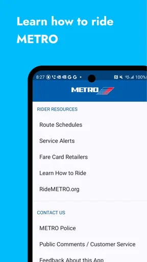
Screenshots
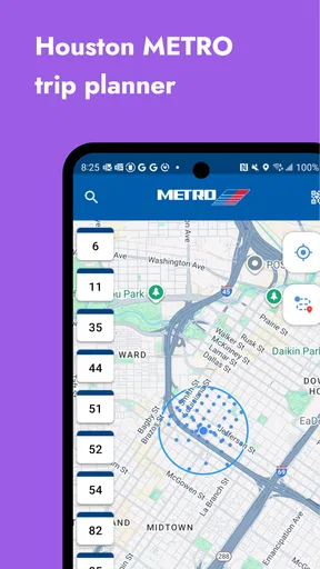
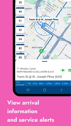
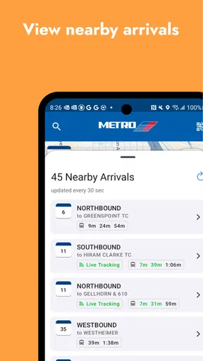
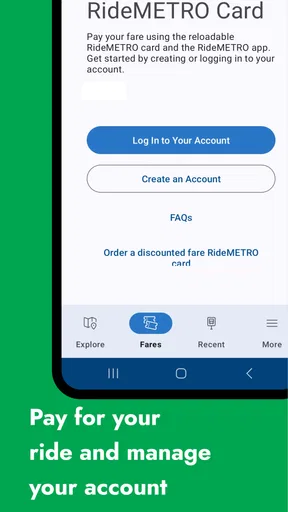
 Analysis by AppCompare
I approached RideMETRO as the kind of app you open when you are already thinking about the next bus or train, not as something you browse for fun. Developed by Houston METRO, it is a free public-transit app for Houston, Texas, and its value depends on one simple question: can it help me make a practical travel decision without adding confusion? My experience is that it can be useful, especially when I want information connected specifically to Houston METRO, but it rewards a little preparation. It is not a universal replacement for every map app, and it is not the best tool for someone who expects every transit problem to be solved automatically.
The app belongs in the Maps & Navigation category, with a store summary focused on public transit in Houston. That narrow purpose is also its main strength. Instead of treating buses and rail as one option among many, RideMETRO puts the local network at the center. I found that useful when I already knew I wanted to use METRO and needed to organize the trip around that system rather than compare driving, walking, cycling, and rideshare routes all at once.
Where the real friction begins
The first difficulty is often not the route itself. It is knowing what information to enter and how much confidence to place in the result. A traveler who opens the app while standing outside an unfamiliar building may not know the exact stop name, the correct direction, or whether the closest-looking stop serves the needed route. That is a normal public-transit problem, but it can make a simple app feel unreliable if the user expects a single tap to produce a perfect answer.
I recommend starting with the destination and then checking the route details carefully instead of choosing the first result automatically. In Houston, a nearby stop can still be inconvenient if it serves traffic in the opposite direction from the one you need. Looking at the complete journey also helps reveal whether a transfer is involved. The shortest-looking option is not always the easiest one when you are carrying luggage, traveling with a child, or arriving at a busy location where crossing streets takes time.
Another common sticking point is timing. A transit app can show a planned journey, but your actual trip still depends on the vehicle, the stop, traffic, boarding time, and transfers. I treat the displayed schedule as a plan to verify, not as a guarantee that removes the need to arrive early. This matters most when the trip has a fixed appointment at the other end.
The most useful habit is to verify the full route before leaving the current location. I check the starting stop, direction, transfer points, and final walking segment while I still have time to adjust. That small routine is more valuable than repeatedly reopening the app after I have already boarded the wrong service.
RideMETRO is also less suitable for people who need a broad city-travel comparison. If you want to decide between METRO, a rideshare, walking, and driving in one screen, a general mapping service may be more convenient. RideMETRO makes more sense when the decision has already been made to use Houston METRO and the remaining job is understanding that network.
Worth Reading Before You Choose

EA SPORTS FC Mobile 26 Is a Bigger Football Game, but It Takes Time

Flipboard Shows What News Apps Must Do Beyond the Feed

Switching to Android Auto Means Rethinking Your Driving Routine

Google Calendar Makes a Crowded Week Easier to Manage

Ludo King Makes the Most of the Minutes Between Plans

Baby Panda World Brings Quick Play to Modern Phones, but Its Game Library Feels Busy
What to check before trusting the first route
I look for the stop name rather than relying only on the map position. A pin may appear close to me while the actual boarding point is on another side of a road, behind a building, or across an intersection. I also read the direction shown for the service. This is a small detail, but it prevents one of the most frustrating transit mistakes: boarding a vehicle on the correct route but traveling away from the destination.
For a transfer, I mentally separate the journey into stages. I ask where I leave the first service, how I identify the next stop, and whether the transfer depends on a tight connection. If the answer to the last question is yes, I create a backup plan before starting. That might mean identifying a later service or remembering a nearby landmark. The app can organize the route, but I still need to understand the physical movement between vehicles.
One less obvious point is that the final walking section deserves as much attention as the transit portion. A route can look efficient on paper while ending at a stop that leaves a longer or less comfortable walk than another nearby option. When I am unfamiliar with an area, I compare the final stop choices instead of assuming the app's first suggestion is automatically the best one.
Setup checks that prevent avoidable problems
RideMETRO is free, has an Everyone content rating, and supports devices running at least iOS version 10. That makes it approachable for many users, but an older operating system or an outdated installation can still create problems before the app has a fair chance to work. The current version is 2.71, so I would first check that the installed copy is current enough for the device and that the phone itself has a stable connection.
I would also open the app before the day of travel rather than waiting until the moment a vehicle is due. This gives me time to learn where the route search, stop information, and relevant trip details appear. It also separates a learning problem from a service problem. If I cannot find the needed information at home, I do not want to discover that while standing at a stop with limited time.
Location setup is another practical checkpoint. If the app uses the phone's position to help identify nearby transit, the result may be less useful when location access is disabled, inaccurate, or affected by a large building. I do not assume that a location dot means the phone has identified the exact entrance or boarding point. I use it as a starting clue and confirm the stop name independently.
Connection quality matters too. A weak signal can make route searches appear slow or incomplete, and repeatedly tapping the same control may create more confusion rather than solve the issue. My approach is simple: wait briefly, confirm whether the request changed, and try again only once. If the phone is struggling generally, I move to a place with better reception before deciding that the app is broken.
Battery planning is easy to overlook. A transit app may be needed at several points: before departure, during a transfer, and near the destination. I prefer to check the route while the battery is comfortable and keep the important stop names in mind. This is not a criticism unique to RideMETRO; it is a sensible precaution whenever a phone is being used as the main travel aid.
A practical pre-trip routine
- Open RideMETRO before leaving and search the complete trip, not just the first leg.
- Read the boarding stop and direction, then compare them with the street layout around you.
- Note every transfer and identify what you will look for when leaving the first vehicle.
- Check the final stop and walking segment, especially if the destination has several nearby entrances.
- Allow extra time when the trip is important or involves a close connection.
This routine also answers a question many new users have: do I need to be an experienced Houston transit rider to use the app? No, but beginners benefit from treating it as a planning aid rather than a substitute for paying attention. The clearer the route is in my head before departure, the less I depend on hurried decisions at each stop.
Recovering when the workflow breaks
When a search does not produce what I expect, I avoid changing several things at once. First, I check whether the starting point is too vague. A precise place or recognizable stop is usually more useful than a broad neighborhood description. Then I check the destination in the same way. If the route changes after that, the original issue was probably the input rather than the transit network.
If the app seems stuck, I close and reopen it, confirm the phone's connection, and try a straightforward search. I do not repeatedly submit a complicated route while the first request may still be processing. This kind of calm reset is basic, but it prevents a temporary loading issue from turning into a string of contradictory results.
A good recovery workflow is to simplify the journey. Instead of searching from an exact building to an exact room or entrance, I search from a recognizable nearby point to the main destination area. Once I understand the transit portion, I handle the short walking details separately. This is particularly helpful when a precise address produces an awkward result or when the map position does not match the entrance I can actually use.
If I miss a vehicle, I do not immediately discard the whole plan. I return to the next available option and check whether the transfer still works. A missed connection can change the timing without making the route itself wrong. The important distinction is between a route that is no longer practical at this moment and a route that was never suitable.
For a trip with several stages, I save mental checkpoints rather than trying to remember every detail. I note the first boarding stop, the transfer location, and the final stop. If the phone becomes difficult to use later, those three pieces can help me ask for directions or interpret signs. This is one of the strongest ways to reduce dependence on a live screen without pretending that the app can work offline in every situation.
Users may also wonder whether reinstalling is the right response to a problem. I would not make that the first step. Reinstalling can be disruptive and does not fix a weak connection, incorrect route input, a device issue, or a service delay. I reserve it for persistent app-specific behavior after simpler checks have failed, and I first make sure I know how to perform the route search again.
When the app is not the cause
Public transit is affected by conditions outside the app. A vehicle can be delayed by traffic, a stop can be difficult to reach because of construction, and a transfer can become impractical because the first service arrived late. In those situations, a correct route may still produce a disappointing trip. I find it more useful to separate information accuracy from service performance: the app can describe the intended journey, while the street determines how smoothly it happens.
Map position can also be misleading around tall buildings, covered areas, and complicated road layouts. If the phone shows me near a stop but I cannot see the boarding area, I look for the stop sign, street name, and direction of traffic. I do not keep walking solely because the blue location marker appears to be moving. Physical signs and the route direction are better evidence than a drifting position dot.
There is a similar issue with timing. A person who arrives exactly when a vehicle is expected may feel that the app failed, but schedules and real-world arrival times are not identical. I build a buffer into important trips and use the app to decide when to leave, not merely when to reach the curb. That distinction is especially important for appointments, flights, exams, or work shifts.
Houston's size can make the difference between a convenient and inconvenient route more significant than the number of transfers alone. A route with one transfer may require a long walk or an uncomfortable wait, while another with more steps may be easier because each stop is clearer. I judge the journey by the entire experience: access to the first stop, transfer effort, waiting conditions, and final walk.
This is where a general navigation app can sometimes be better. It may provide a wider view of walking routes, driving alternatives, and nearby businesses. RideMETRO remains the more focused choice when I want to stay within Houston METRO's transit context. Rather than choosing one app permanently, I use the specialist tool for transit planning and a broader map when the surrounding streets or final destination need more attention.
Who will appreciate the focused approach
RideMETRO is a sensible fit for Houston residents who regularly use METRO and want a dedicated way to think about their journeys. It can also help visitors who have already decided to use public transit and prefer not to filter through unrelated travel options. Students, occasional riders, and people planning a new commute may appreciate the focused interface, provided they take time to verify stops and transfers.
I would be more cautious about recommending it as the only navigation tool for someone unfamiliar with Houston, traveling under severe time pressure, or needing constant comparisons with other transport modes. It is also not the ideal choice for a user who dislikes checking route details and expects the phone to guide every step automatically. Transit still requires observation, and the app cannot remove that responsibility.
The audience size suggests that it is an established local tool: RideMETRO has more than one hundred thousand installs, with an average rating of 3.4 from around one thousand six hundred ratings and 634 reviews. I read that as a mixed but understandable signal. The app has enough adoption to be relevant, yet the rating encourages realistic expectations rather than blind trust. Local usefulness can coexist with rough edges, especially in a tool affected by changing transit conditions.
My practical verdict after using it
RideMETRO succeeds when I use it for what it is: a focused Houston METRO companion for planning and checking public-transit journeys. I like that the app is free and that its purpose is immediately relevant to riders who do not need a full travel marketplace. The developer, Houston METRO, is also clearly connected to the local system, which makes the app feel more appropriate for network-specific planning than a generic map alone.
Its weaknesses are mostly about expectations and workflow. A first-time rider can still choose the wrong side of the street, underestimate a transfer, or misread a nearby stop. A weak connection or inaccurate phone location can make the experience feel worse, and a real-world delay can be mistaken for an app error. None of those issues should be ignored, but they are reasons to use the app thoughtfully rather than reasons to expect it to function like a personal travel guide.
For an everyday scenario, imagine leaving work for an appointment across Houston. I would open the app before walking out, identify the first stop and direction, inspect the transfer, and check the final walking segment. I would leave a buffer instead of timing my arrival to the minute. If the first vehicle were late, I would reassess the next connection rather than repeatedly restarting the entire search. That workflow turns the app from a rushed answer machine into a practical planning tool.
RideMETRO is free to use, carries an Everyone rating, and was released on April 10, 2012, so it has a long presence in the transit-app space. Its current version, 2.71, supports devices from iOS 10 onward. Those details make it accessible to a broad range of iPhone users, while the moderate rating is a reminder to keep a backup habit for important journeys.
My recommendation is therefore specific: choose it if your trips are centered on Houston METRO and you are willing to read the route, confirm the direction, and allow time for real-world variation. Pair it with a broader map when you need detailed walking or alternative transport comparisons. It is most valuable as a dependable planning companion, not as a promise that every ride will unfold exactly as displayed. With that expectation, I would recommend giving RideMETRO a try for regular Houston transit use; without it, another navigation option may feel more forgiving.
Pros
- Real-time train and bus updates help reduce waiting at stations.
- Trip planning combines routes
- schedules
- and nearby Metro stops.
- Service alerts make it easier to spot delays or planned closures.
- Station information can simplify transfers and route decisions.
- Useful for both regular commuters and occasional visitors.
Cons
- Some features may depend on location services and internet access.
- Service information can occasionally lag behind real-world changes.
- The interface may feel crowded for users unfamiliar with the transit network.
- Route options may be limited when disruptions affect multiple lines.
- Battery and data usage can increase when maps and location tracking are active.
FAQs for RideMETRO
What is RideMETRO and what can I use it for?
RideMETRO is the official mobile app for planning and managing trips on the METRO transit system. After installing it, you can use the app to check routes, view schedules, locate nearby stops or stations, and receive service information. It is designed to make daily commuting easier by putting essential transit details in one place before and during your journey.
Does RideMETRO provide real-time bus or train information?
RideMETRO may provide real-time arrival predictions and service updates for supported routes, stops, and stations, helping you estimate when your vehicle is expected to arrive. However, predictions can change because of traffic, weather, operational issues, or technical limitations. For the most accurate results, allow the app to use your location and check the information shortly before traveling.
Can I plan a complete trip with RideMETRO?
Yes, RideMETRO is intended to help users plan public transportation journeys from one location to another. You can typically enter a starting point and destination, review available routes, compare departure times, and identify transfers or walking segments. The exact planning options may depend on the local METRO system, current service conditions, and whether location services are enabled on your device.
Does RideMETRO require an internet connection or location access?
An internet connection is generally needed to load current schedules, trip-planning results, real-time vehicle information, alerts, and other updated transit data. Location access is useful for finding nearby stops and setting your current position as a trip origin, although some features may work without it. If permissions are denied, you may need to enter addresses or stop names manually.
Is RideMETRO free to download, and does it replace a transit ticket or fare card?
RideMETRO can generally be downloaded without an upfront charge, but standard mobile data costs may apply when using the app over cellular networks. The app’s role is primarily to provide transit information and trip assistance; it should not automatically be assumed to replace a physical fare card, ticket, or payment method. Check the fare and payment options available for your specific METRO service before traveling.


